Supplement - How to map your run with google earth
Okay lots of my friends ask me, How do you map out your route with distance calculate ? Simple i use google earth.
Heres a step by step guide on how you can do all that.

Launch google earth and look for singapore..remember to zoom in on the location where you want to do your run.

Select measure from tools section

Select path from the tab in the pop up box. PS : make sure you select kilometers. If you use other metric system just select the other shown in the dropdown list. Martians metric system not supported thou..
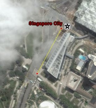
Now use the crosshair and start ploting your path. The distance covered will be shown in the pop up box.
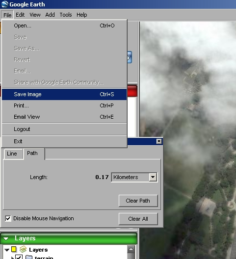
After you are done with the plotting you can save it as an image or as a location VMZ format for future reference.
Cool anit it !
posted by Ethanolic at 2:34 PM
![]()


2 Comments:
Thanks. Been trying to figure out how to use the program for a long time. How do you find say a exact street tho?
tekko : you have to visually located it! thats the problem man.
Post a Comment
<< Home